
The Mere With No Tales
Searching for folklore at Saham Toney Mere

I find it is a necessity of many fieldwork trips to inspect local pubs at some point during the course of the day. This was particularly important in the case of Saham Toney Mere, as it is currently a private fishing lake, and the only way I could fathom to (legally) view the mere was from the beer garden of The Old Bell.
Saham Toney Mere is located, naturally, in Saham Toney, a Norfolk village in the Breckland area of Norfolk near Watton. ‘Saham’ means ‘homestead by the lake’ in Old English and the Toney part of the name relates to the Norman landowner Ralph de Toeni. The reason I was keen to visit this mere (bar the aforementioned pub) was because it is located in an area I have been perusing on the map for a while. Nearby, and also visited on the day, were The Peddar’s Way, The Merton Stone, Carbrooke and Wayland Woods. They all have their own folktales to tell, but in the case of Saham Toney Mere, those tales have been rather more challenging to discover.
When viewed from above on Google Maps, Saham Toney Mere strikes me as rather odd. See image below:
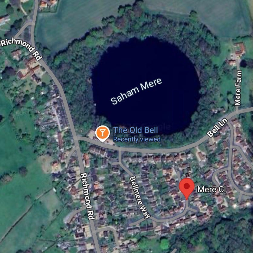
A shallow freshwater mere fed by a chalk aquifer, almost a perfect circle, right in the centre of the village. In the Victorian age it was said to be:
“abounding in fish, especially eels of two species, one noted for their deliciousness, and the other for their nauseous flavour” - William White’s History, Gazetteer and Directory of Norfolk (1864)
I conjectured that a body of water such as this must be hiding some secrets. However, I could not find any mention of legend or folklore relating to the village or the mere anywhere online.
There are other meres nearby that have interesting tales attached to them.
Langmere: Also fed from below by a chalk aquifer leading to naturally fluctuating water levels:
“It used to be said that any shepherd or cattleman who drove his animals on to the island would suffer misfortune or illness. The water was believed to be the domain of the Devil. And none would ever dare hunt fowl or fish there” - Robert Hale “Breckland’ (1956)
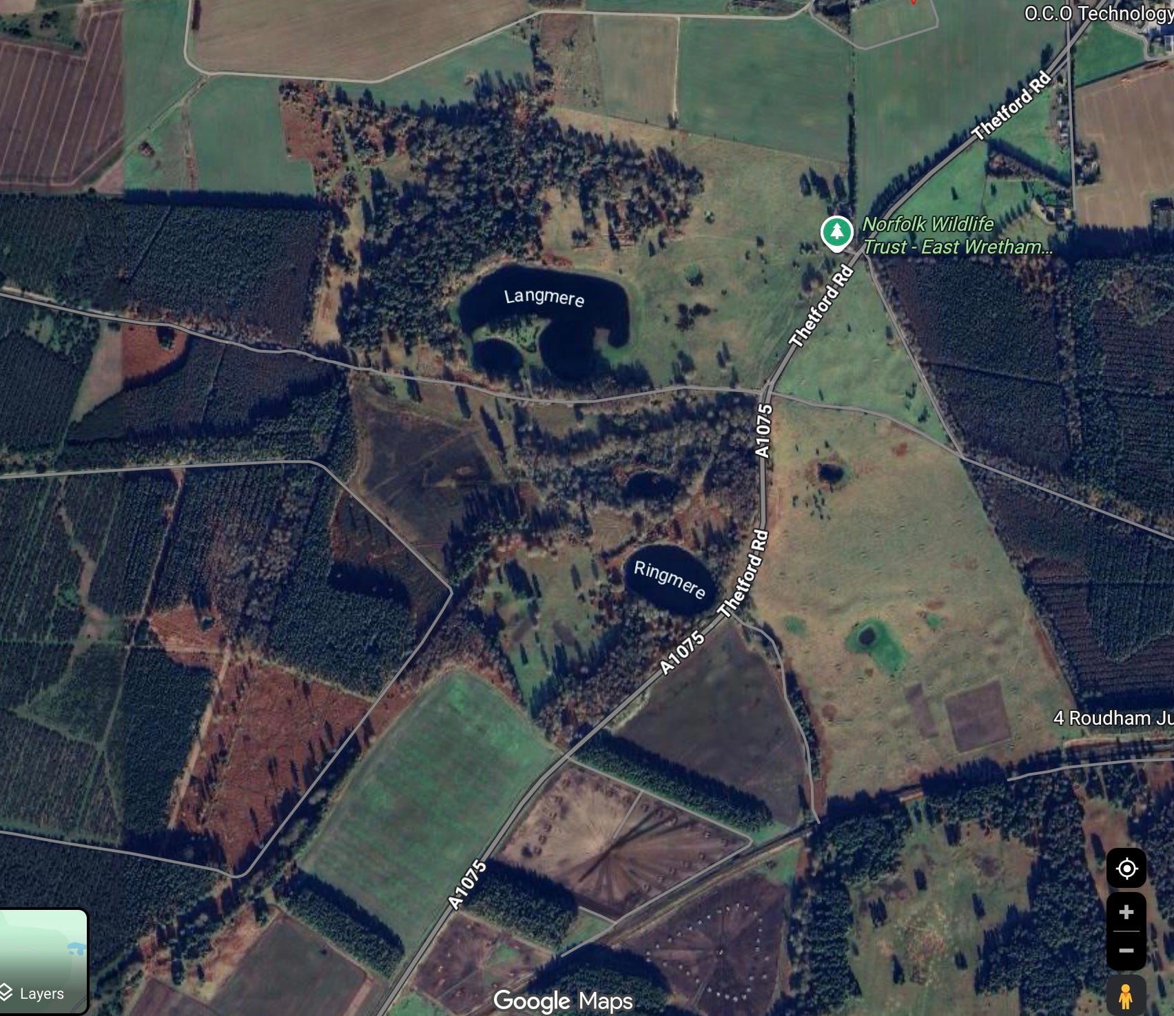
Fowlmere: The water, like that of Langmere, rises and falls depending on the levels in the chalk beneath. Due to the slow speed at which the water is filtered the puzzling effect sometimes occurs of them being empty after heavy rainfall and full during drought. A tale collected by J.D. Salmon in 1834 from a man who lived nearby states:
“[he] walked around the mere every Sunday. His grandfather remarked that when the mere is very high, wheat is dear, and on the contrary when the water is low”
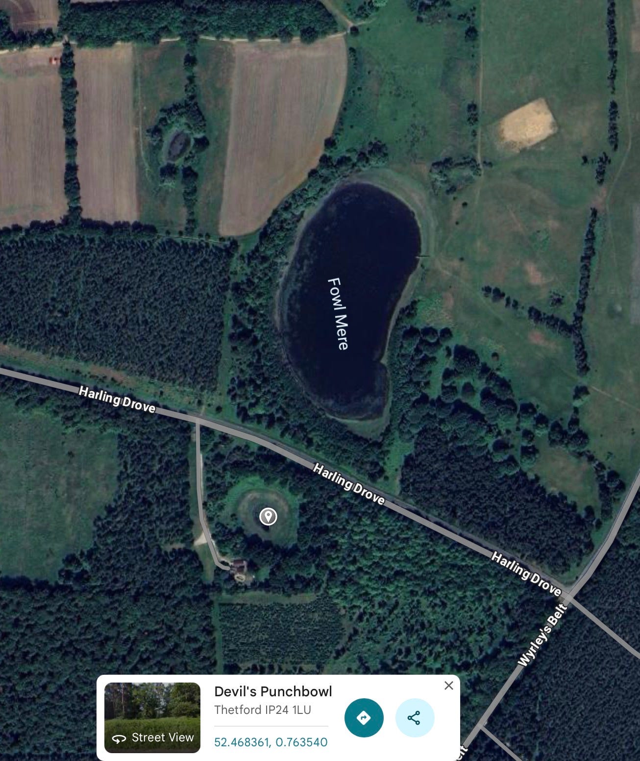
On the opposite side of Harling Drove Road there is also a smaller mere known as the Devil’s Punchbowl which conjures up all sorts of associations and was presumably one of the many landscape features attributed to the devil.
But try as I might online, I could not find anything other than scientific/geographical information. Hence the inescapable visit to The Old Bell which backs on to the south side of Saham Toney Mere. Pictured below, right in front of the mere, on the cover of an historical leaflet I found online:
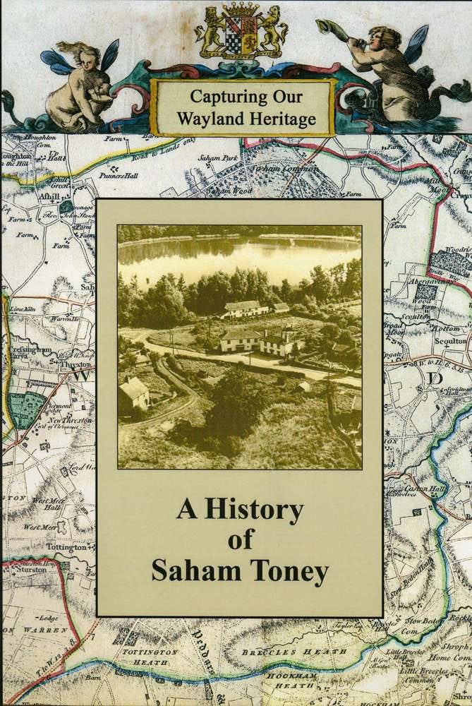
Luckily it was a warm and sunny day on the 1st May so my requirement to sit in the beer garden to eat our lunch did not raise any eyebrows. The trees, shrubs and undergrowth around the mere are very thick. It’s almost impossible to see the mere from the road and it appears more woodland than water. Perhaps in the winter when the trees have lost their leaves it is easier to spot.
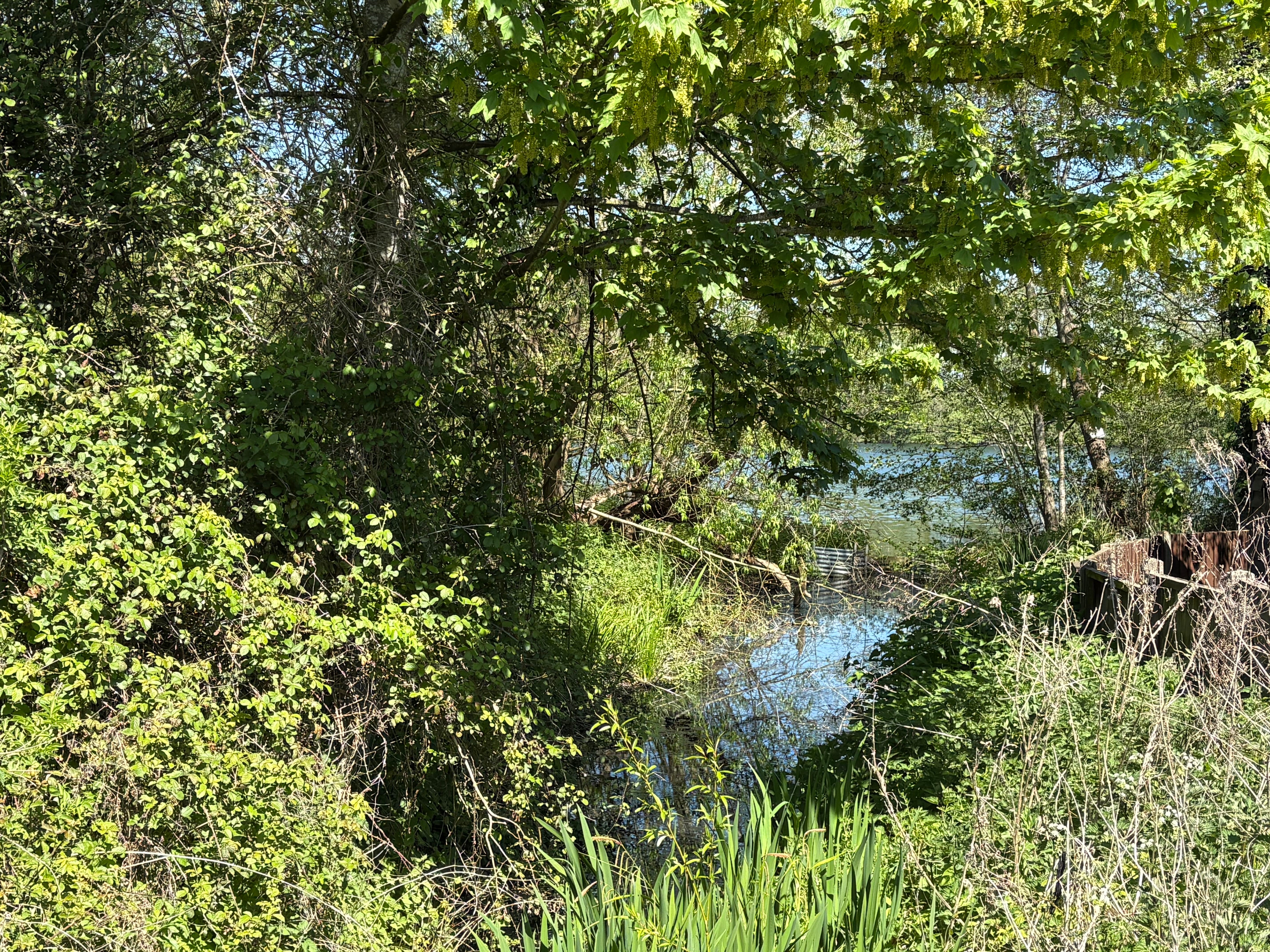
Saham, as mentioned above, means homestead by the lake in Old English. It is therefore safe to assume that, to the Saxons who named (or re-named) the village, the mere was an integral part of daily life. Various archaeological discoveries ranging from Mesolithic to the Saxon have been made. It has been theorised that Saham Toney was a power centre for the Iceni tribe prior to the Boudican revolt due to the identification (via crop marks) of a fort straddling the Peddar’s Way where it crosses a stream believed to be first built by the Iceni and latterly altered by the Romans.
Surely a place with so much history, so curious a location and such an uncanny appearance must have a legend or odd occurrence connected to it. Fairy, witch, meremaid? Not a whisper was to be found on the waves of the World Wide Web.
I therefore began writing this article with the intention of speaking of the absence of folklore, the forgotten tales and unknowable history. A final, quick online image search below photograph of the Saham-Toney village sign located outside the church, I was pleasantly surprised to see that it did in fact depict the mere.
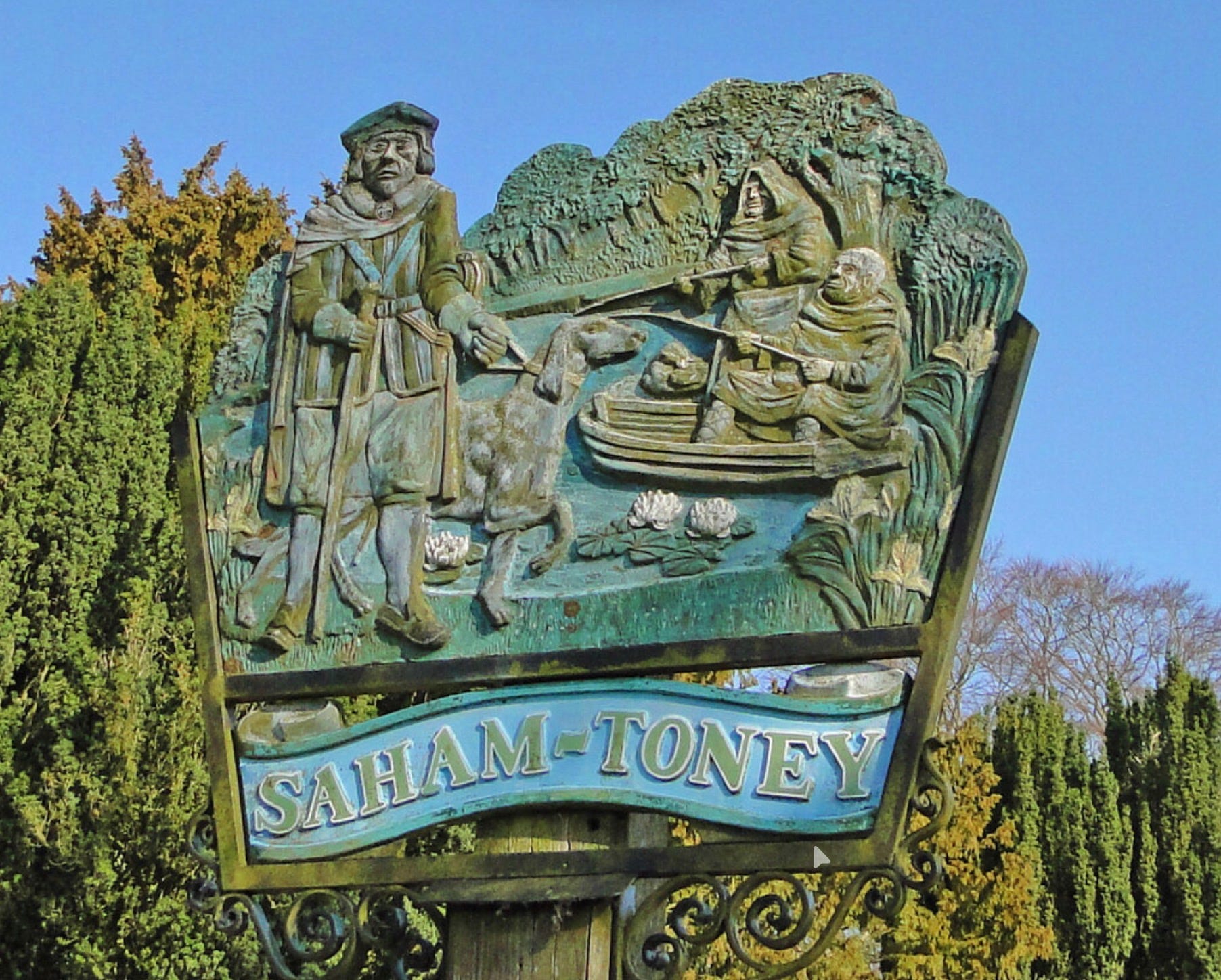
This led me to consult a pamphlet I’ve recently acquired: East Anglian Village & Town Signs by Ursula Bourne (1986) and to my great satisfaction I discovered the below entry underneath an earlier version (with the same imagery) of the Saham Toney village sign:
“Saham Toney: a village just north of Watton, has a fine church, by which the village sign stands, and nearby is a mere which is said to have appeared in a night. The mere, backed by numerous trees, is shown in the sign, and the boat with two clerical fishermen recalls that monks from Castle Acre Priory were allowed to fish in the mere twice a year. The figure in the foreground, with his dog, is Sir Roger Toni, an early lord of the manor.”
A mere which is said to have appeared in a night.
I wonder what the local residents attributed the sudden appearance to? Perhaps the devil, like its neighbours Langmere and the Devil’s Punchbowl? Whatever the case may be, I am satisfied to have uncovered a tale (however small) that attaches Saham Toney Mere to the folklore of the Breckland landscape.